New version v2 of Arctic SSS L3 maps from Locean
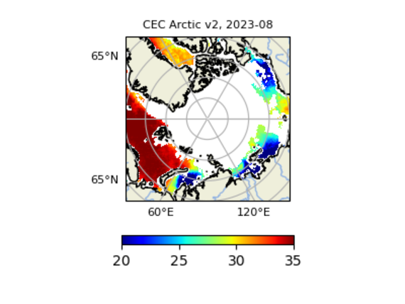
A new version (version 2) of SMOS Arctic SSS L3 maps generated by LOCEAN /ACRI-ST is available on CATDS CEC-OS.
LOCEAN and ACRI-ST have derived improved level 3 (L3) SMOS Sea Surface Salinity (SSS) maps over the Arctic Ocean. With respect to SMOS ARCTIC SSS L3 V1.0, main changes in version 2.0 are as follows:
- 9-day and 18-day maps are provided over the June 2010 to August 2023 period,
- the methodology originally derived by Supply et al. [2020] and implemented in SMOS ARCTIC SSS V1 maps has been revisited,
- a temporal optimal interpolation with a bias removal depending on the SMOS observation geometry (see a general description in [Boutin et al., 2018]) has been added,
- comparisons with independent in situ datasets, conducted in CEC LOCEAN and in PIMEP, indicate a clear improvement (reduction of std difference by ~a factor 2 and systematic increase of r2); with V2.0 r2 is greater than 0.8 with 40% of the data sets considered at PIMEP.
As in version 1, SSS maps are provided on an Equal-Scalable Earth Grid 2 (EASE, https://nsidc.org/data/ease) with a Northern Hemisphere Azimuthal projection and a resolution of 25km.
Figure 1 : SMOS SSS from CATDS CEC ARCTIC V2.0 in August 2023.
LOCEAN and ACRI-st work as Ocean Salinity Center of Expertise for CATDS (CATDS CEC-OS) in order to improve methodologies to be implemented in the future in the near real time CATDS processing chain (CATDS-CPDC). Feedbacks from users about the quality of these new products are very welcome, as they are experimental.
More information and data access here.


